下载App
资质规则
旅行
账户
4tuataras
An absolutely ‘Must do’ hike!!
Mt. Asahidake的点评
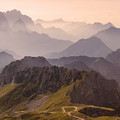
点评:What an amazing hike (Mt Asahidake loop)! It was definitely one of the top 3 we’ve ever done.
Make sure you start earlyish (we were on the trail at 0900), so tgat you can take your time, in order to make the last cable car back down (don’t miss it! It’s published in the cable car station).
We did the hike in an anti clockwise direction from the cable car, heading up to the summit (as our 1st point). We had extremely poor visibility and it was incredibly windy! We are 56 year olds, relatively fit, and it took us 1 & 1/2 hrs to reach the summit (with a walking pole and tramping boots).
Unfortunately, there was nothing to see at the summit (shocking visibility ), so we didn’t stay for long. We then took the trail down, heading towards the ‘foot onsen’ and back down to the cable car.
The next section from the summit was extremely icy for about 500m with poor visibility (we use Alltrails to keep us on track, as you couldn’t see the path- apart from the well positioned ‘pink ribbon’ rocks). We joined another 2couples with making our way down this slope, with my hubby ‘making footsteps’ for the rest to follow in (as they were only wearing runners/sneakers). Again, boots and a pole were invaluable!
The weather began to clear about an hr into the downward part, and we had great visibility /sun for the last 1 & 1/2 hrs.
It took us about 5 hrs of hiking, and about 45 min of stops (including onsen). We broke the trail up into ‘3rds’, with the first being the summit, the 2nd to the onsen (hot pool which is magic on your feet!) and then to the cable car.
I would say that boots and a pole are a must! The first part is a rocky scramble (although you can walk up it- but having a pole was great). And walking down can be hard on the knees, with the big rocky ‘steps’. We also had a few small river crossings/step across and muddy/wet trails for the last 3rd, so boots makes it much easier.
We all had bear bells (no spray), but saw nothing. And the map in the cable car station showed that the last bear sighting had been 11 days earlier.
Take lots of food/water (we also had a lemon soft drink which was great). We didn’t need half of the water, but if it had been a hot day, we would have. The temp was 13 deg C when we stated, and we all had rain jackets on for the first 2 & 1/2 hrs.
Just amazing!
It reminded us as a combination of Helvellyn (UK), Kepler (NZ), Valbonna (Albania) and Cradle Mountain (Tasmania). A bit of everything!
Make sure you start earlyish (we were on the trail at 0900), so tgat you can take your time, in order to make the last cable car back down (don’t miss it! It’s published in the cable car station).
We did the hike in an anti clockwise direction from the cable car, heading up to the summit (as our 1st point). We had extremely poor visibility and it was incredibly windy! We are 56 year olds, relatively fit, and it took us 1 & 1/2 hrs to reach the summit (with a walking pole and tramping boots).
Unfortunately, there was nothing to see at the summit (shocking visibility ), so we didn’t stay for long. We then took the trail down, heading towards the ‘foot onsen’ and back down to the cable car.
The next section from the summit was extremely icy for about 500m with poor visibility (we use Alltrails to keep us on track, as you couldn’t see the path- apart from the well positioned ‘pink ribbon’ rocks). We joined another 2couples with making our way down this slope, with my hubby ‘making footsteps’ for the rest to follow in (as they were only wearing runners/sneakers). Again, boots and a pole were invaluable!
The weather began to clear about an hr into the downward part, and we had great visibility /sun for the last 1 & 1/2 hrs.
It took us about 5 hrs of hiking, and about 45 min of stops (including onsen). We broke the trail up into ‘3rds’, with the first being the summit, the 2nd to the onsen (hot pool which is magic on your feet!) and then to the cable car.
I would say that boots and a pole are a must! The first part is a rocky scramble (although you can walk up it- but having a pole was great). And walking down can be hard on the knees, with the big rocky ‘steps’. We also had a few small river crossings/step across and muddy/wet trails for the last 3rd, so boots makes it much easier.
We all had bear bells (no spray), but saw nothing. And the map in the cable car station showed that the last bear sighting had been 11 days earlier.
Take lots of food/water (we also had a lemon soft drink which was great). We didn’t need half of the water, but if it had been a hot day, we would have. The temp was 13 deg C when we stated, and we all had rain jackets on for the first 2 & 1/2 hrs.
Just amazing!
It reminded us as a combination of Helvellyn (UK), Kepler (NZ), Valbonna (Albania) and Cradle Mountain (Tasmania). A bit of everything!
翻译:真是一次棒极了的徒步之旅(旭岳环山路线)!这绝对是我们经历过的最精彩的三次徒步体验之一。
务必早点出发(我们早上9点就踏上行程),这样才有足够的时间慢慢走,也能赶上最后一班下山的缆车(千万别错过哦!时刻表就在缆车站公布)。
我们从缆车站出发,逆时针方向攀登,以山顶作为第一站。当时能见度极差,风也大得惊人!我们都是56岁的人啦。我们的体能还算不错,借助徒步杖和登山靴,我们只用了1个半小时就登上了山顶。
可惜的是,山顶上什么也看不见(能见度极差),所以我们没在那里停留太久。随后我们沿着山路下山,前往“足汤”处,最后回到缆车站。
从山顶往下约500米的一段路上冰层极厚,能见度也很差(我们借助Alltrails来确保自己没有走错路)。由于看不到路径——除了那些位置显眼的“粉色丝带”状岩石外)。我们和另外两对情侣一起沿着斜坡下行,我丈夫则为其他人“踩出脚印”以供借鉴(因为他们都只穿着跑鞋/运动鞋)。同样,徒步靴和登山杖在此刻发挥了巨大作用!
下山约一小时后天气开始放晴,在最后的1个半小时里视野极佳且阳光明媚。
整个徒步过程耗时约5小时,中途休息时间则约为45分钟(包括泡温泉的时间)。我们把路线分成了三段:第一段是通往山顶的路程;第二段是到温泉池的路线(那里的热水对缓解疲劳简直神奇!);第三段则是前往缆车站的路线。
我建议一定要穿上靴子并带上登山杖!第一段路多为岩石地带,虽然也能步行上去,但有登山杖会方便很多。由于有许多巨大的岩石“台阶”,下山时对膝盖负担较大。在最后一段路中,我们还需涉过几条小河、跨过一些障碍物,路面上也较为泥泞潮湿,因此穿靴子能大大减轻行走难度。我们都带了防熊铃(没带防熊喷雾),但什么也没看到。缆车站里的地图显示,最后一次看到熊是在11天前。
带上充足的食物和水吧(我们还带了柠檬味软饮料,味道很不错)。我们其实用不到一半的水,但如果那天很热的话就另当别论了。出发时气温为13摄氏度,在最初的2个半小时里我们都穿着雨衣。
真是太棒了!
这让我们联想到英国的赫尔韦林山以及新西兰的开普勒山——两者结合体吧。瓦尔博纳(阿尔巴尼亚)和克radle山(塔斯马尼亚)。什么都有一点!
务必早点出发(我们早上9点就踏上行程),这样才有足够的时间慢慢走,也能赶上最后一班下山的缆车(千万别错过哦!时刻表就在缆车站公布)。
我们从缆车站出发,逆时针方向攀登,以山顶作为第一站。当时能见度极差,风也大得惊人!我们都是56岁的人啦。我们的体能还算不错,借助徒步杖和登山靴,我们只用了1个半小时就登上了山顶。
可惜的是,山顶上什么也看不见(能见度极差),所以我们没在那里停留太久。随后我们沿着山路下山,前往“足汤”处,最后回到缆车站。
从山顶往下约500米的一段路上冰层极厚,能见度也很差(我们借助Alltrails来确保自己没有走错路)。由于看不到路径——除了那些位置显眼的“粉色丝带”状岩石外)。我们和另外两对情侣一起沿着斜坡下行,我丈夫则为其他人“踩出脚印”以供借鉴(因为他们都只穿着跑鞋/运动鞋)。同样,徒步靴和登山杖在此刻发挥了巨大作用!
下山约一小时后天气开始放晴,在最后的1个半小时里视野极佳且阳光明媚。
整个徒步过程耗时约5小时,中途休息时间则约为45分钟(包括泡温泉的时间)。我们把路线分成了三段:第一段是通往山顶的路程;第二段是到温泉池的路线(那里的热水对缓解疲劳简直神奇!);第三段则是前往缆车站的路线。
我建议一定要穿上靴子并带上登山杖!第一段路多为岩石地带,虽然也能步行上去,但有登山杖会方便很多。由于有许多巨大的岩石“台阶”,下山时对膝盖负担较大。在最后一段路中,我们还需涉过几条小河、跨过一些障碍物,路面上也较为泥泞潮湿,因此穿靴子能大大减轻行走难度。我们都带了防熊铃(没带防熊喷雾),但什么也没看到。缆车站里的地图显示,最后一次看到熊是在11天前。
带上充足的食物和水吧(我们还带了柠檬味软饮料,味道很不错)。我们其实用不到一半的水,但如果那天很热的话就另当别论了。出发时气温为13摄氏度,在最初的2个半小时里我们都穿着雨衣。
真是太棒了!
这让我们联想到英国的赫尔韦林山以及新西兰的开普勒山——两者结合体吧。瓦尔博纳(阿尔巴尼亚)和克radle山(塔斯马尼亚)。什么都有一点!

© 2026 Tripadvisor 版权所有。
部分照片由 VFM Leonardo 提供。
TripAdvisor公司对外部网站的内容一概不负责。优惠价格中不含税和其他费用。
ICP证:沪B2-20200433
沪ICP备20013175号
 沪公网安备31010502005427号
鹰程信息技术(上海)有限公司