下载App
资质规则
旅行
账户

311queenj
Summer short cut
Mossbrae Falls的点评
点评:Yes, it's technically illegal to visit these falls. Is it enforced? No. Not anymore. There hasn't been an accident in a few years, so enforcement has fallen to the wayside. Many people were there the day we went, which was the last Tuesday in July.
During the SUMMER months, you do not need to walk all the way to Scarlett Way and then to the bridge only to backtrack 40+ minutes on the railroad tracks.
Here's the SHORT CUT when the river water is LOW:
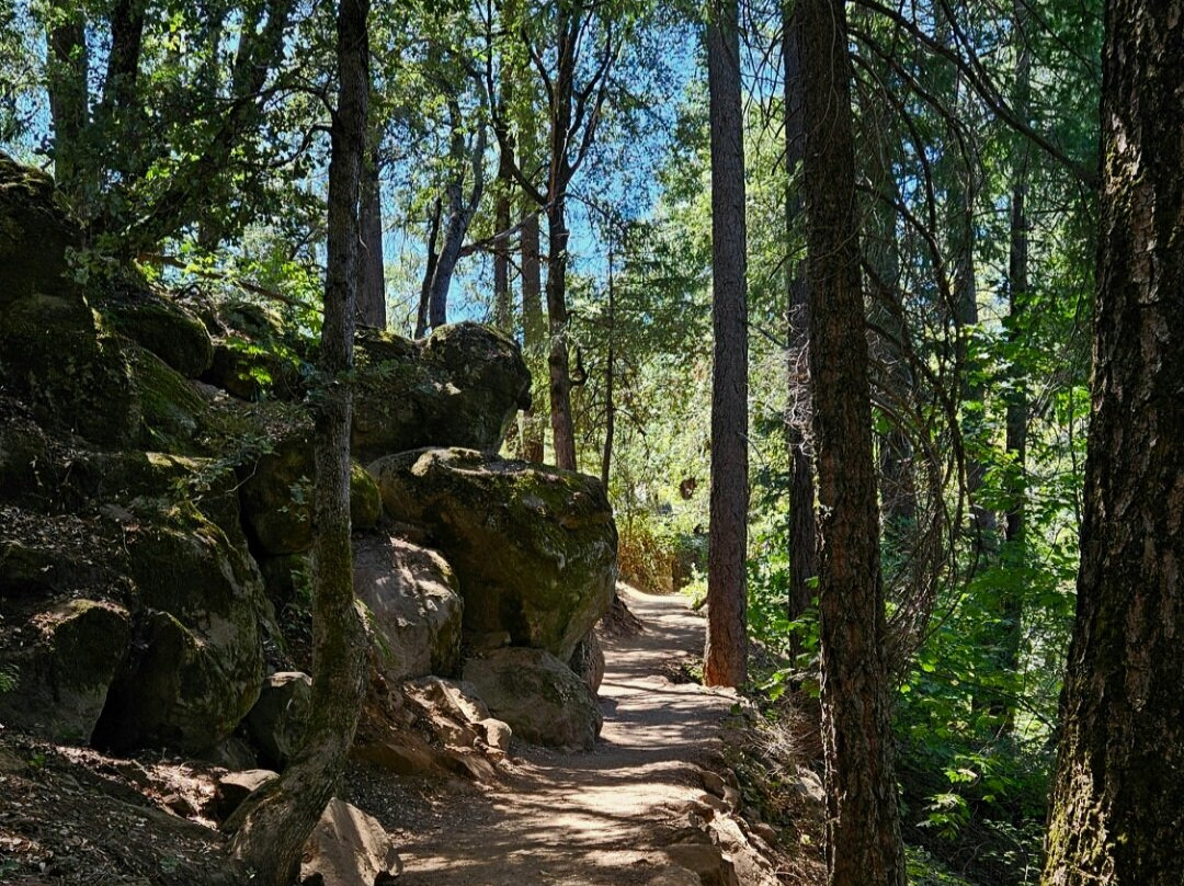
Park for free at Hedges Falls and walk the 1/4 mile down to the small waterfall. Then continue along the trail down a couple switchbacks to the river.
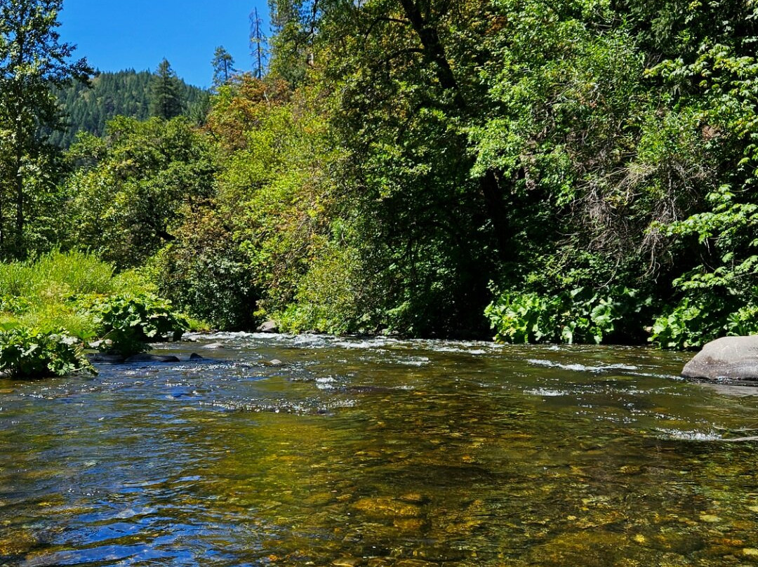
CROSS THE SACRAMENTO RIVER. At the end of July 2026, the river was about 40ft wide, and the deepest point was about mid-thigh for a few steps. The rest of the crossing was only about knee-deep.
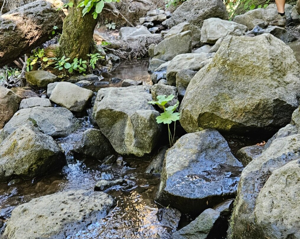
Shoes with good grip are strongly recommended as the rocks are slimy. The big rocks are the most slippery, so concentrate on stepping between large rocks onto the bed of flattish golfball and baseball-sized rocks. They are also slippery and shift when you step on them, but you will still find solid footing; whereas, you will slide right off a big rock and fall - even if it appears to be flat.
Many visitors crossed this stream without issue. A few people did turn back. Without the confidence of having good balance and proper shoes, it is much more difficult. This is the only hard part of the hike. Just take it slowly.
On the other side, there's a chest-high mud bank with some tree roots. It may not look like it, but this is the path up to the railroad tracks. There's a little grassy toe-step in the mud bank to the left. This step raises you halfway up the bank. Put your left foot on it and then grab the tree roots to pull yourself up to the top of the bank with your right foot step. That's it. It sounds harder than it is. No one had issues getting up - children, seniors, the less adventurous...
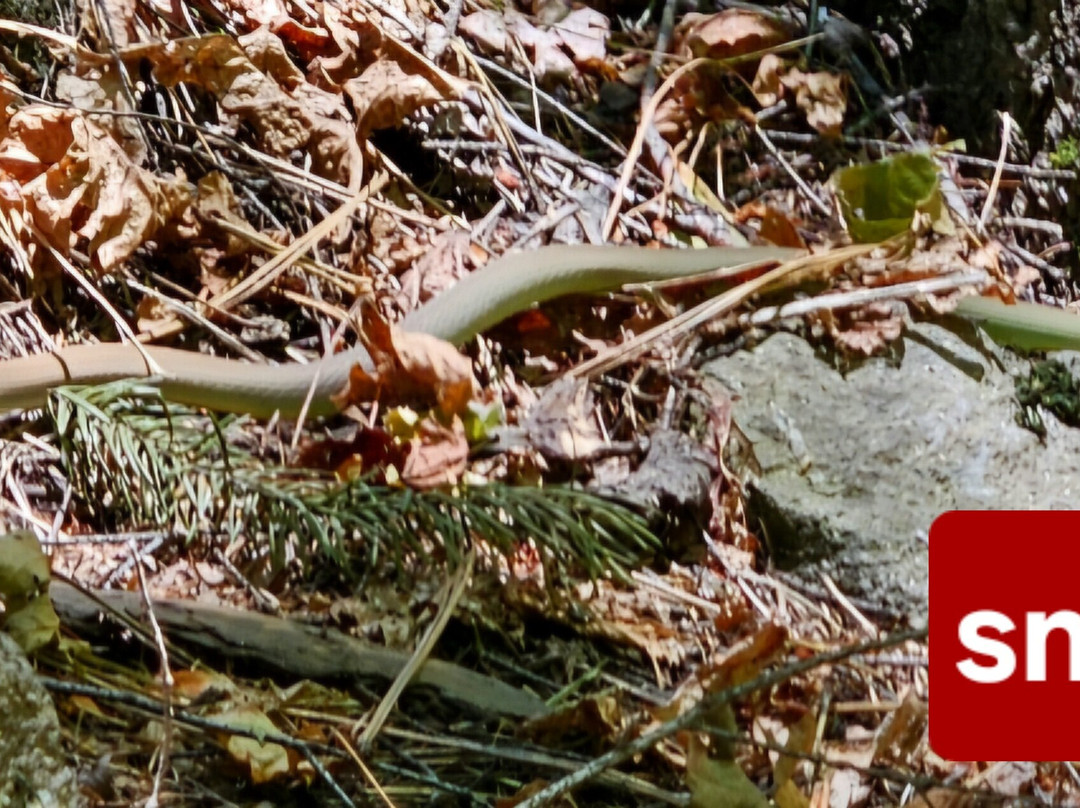
Then you follow the path for about 2 minutes up to the railroad tracks. The path is a little rocky and not as clear cut, but you can still tell where the path is. I advise staying on the path as we did see a long, fast-moving, green snake silently slithering from one hole to another just a few feet away.
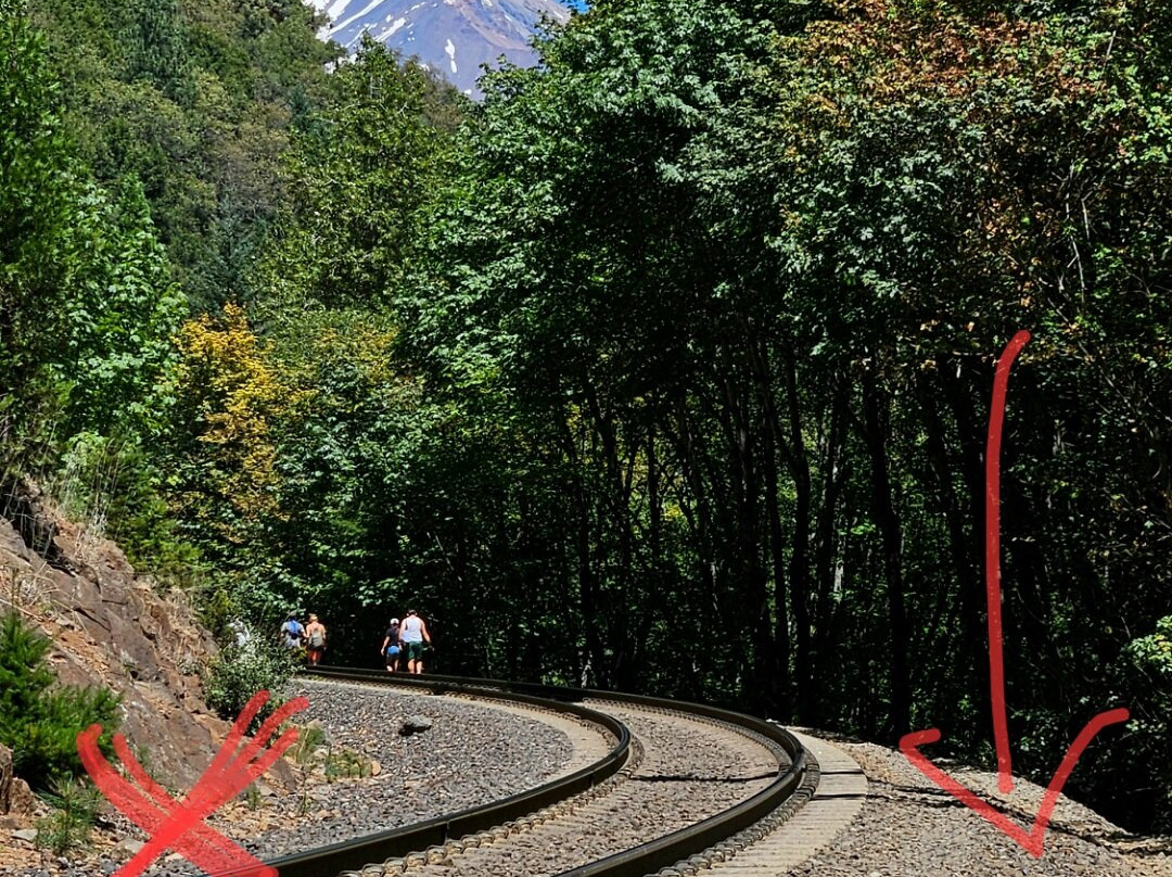
Once you're up on the railroad tracks, you will walk out in the open along the tracks. There's no shade, and it's hot, but so much shorter than the MILE you'd walk if you went the long way. From here, it's only about an 7 or 8 minute walk along the tracks.
Obviously, walk on the right side of the tracks where there's room to walk. This is a LIVE railroad line and from the riverbank, we did see a very long train pass going about 40mph.
Do NOT wear earbuds or walk in the middle of the tracks. This is why there was a fatality, and the hike became illegal. The roar of the river is quite loud - even during the dry season. Look, listen, and feel for the train, and be prepared to walk single-file in the shale rocks next to the trqck should a train pass.
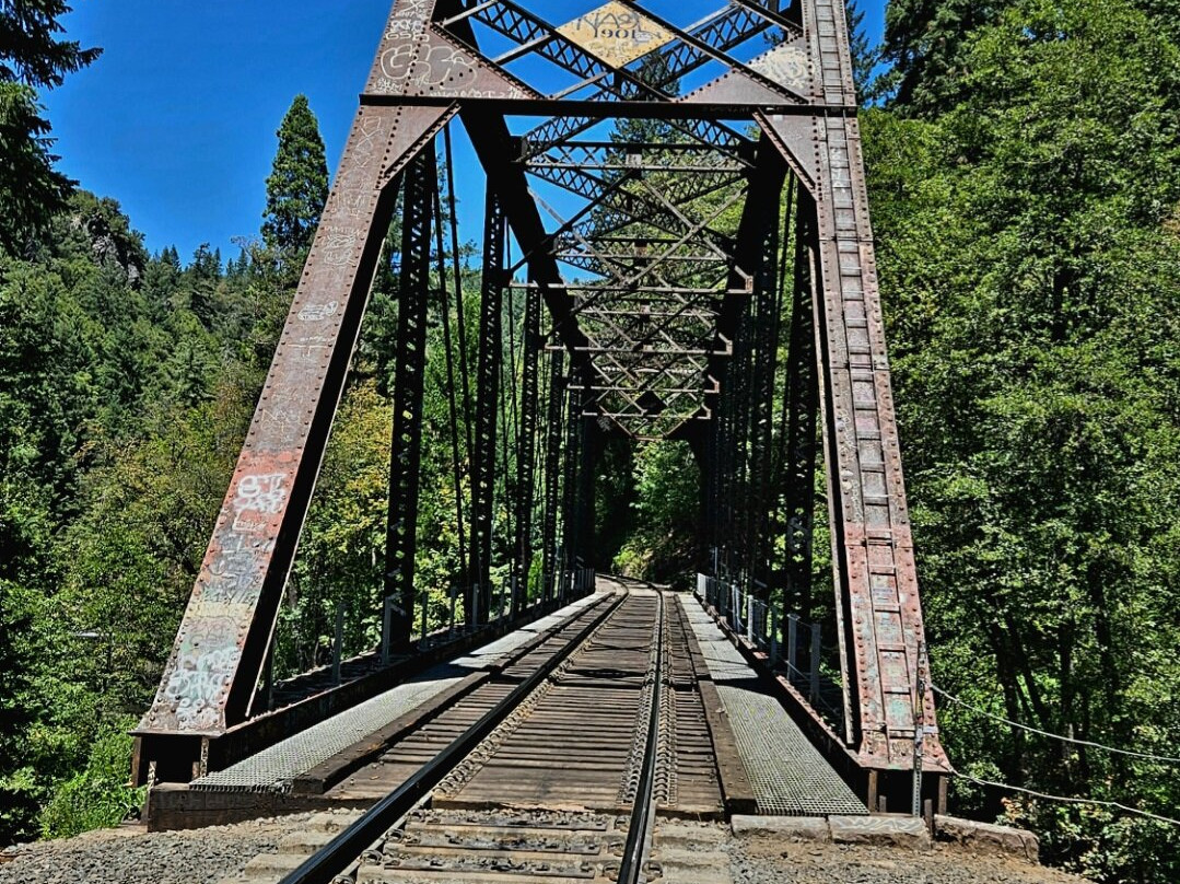
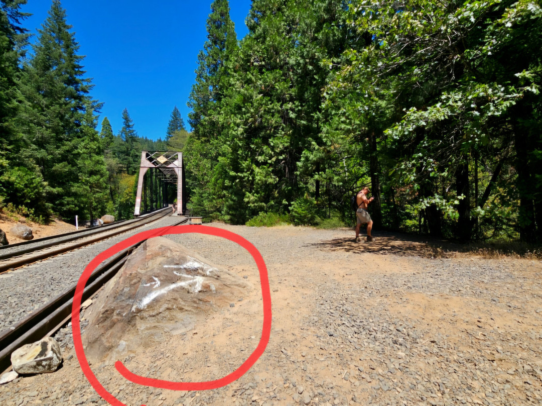
When you first see the train trestle, look to the right off the tracks for a big yellowish rock. You will NOT cross the iron train bridge. Instead, approach the rock and you'll see a white arrow painted on it that points to the trees on your RIGHT.
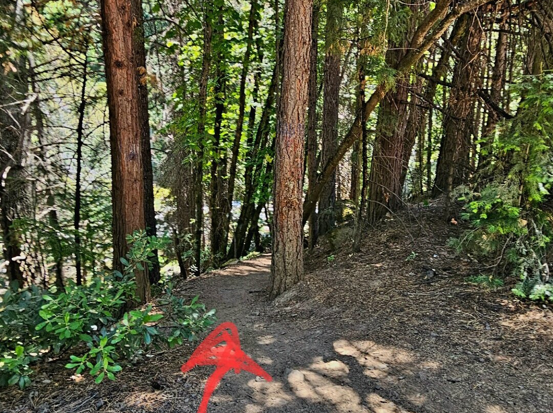
It looks like nothing's there, but when you get under the shade of the trees, you will see a dirt path that leads to the right and down to the falls in just a few minutes.
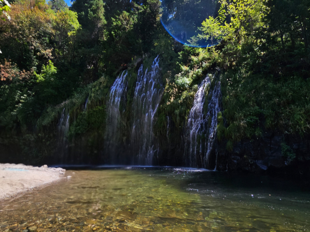
At the falls, there are some dry mud/sand banks to sit on. The water is shallow, but chest-deep in some places. It was very cold, but people were swimming.
The entire hike one-way took maybe...30 minutes, and that's only because it's slow crossing the river and walking on the shale rocks next to the railroad tracks. Nevertheless, it's less than half the time you'd spend walking the long way from the resort, across the bridge, and 1 mile down the tracks.
NOTE: Don't use this route in any other season. Keep in mind that the rains here begin in mid-September and typically continue through June. Outside of dry July and August, the water may be too high to cross.
**I did just read that funding has finally been approved to build an official path from Hedges Falls to Mossbrae Falls - one that avoids the use of the railroad tracks. But it'll be several years before that project is completed.
Until then, may you enjoy this shortcut to the beautiful mossy falls.
During the SUMMER months, you do not need to walk all the way to Scarlett Way and then to the bridge only to backtrack 40+ minutes on the railroad tracks.
Here's the SHORT CUT when the river water is LOW:
Park for free at Hedges Falls and walk the 1/4 mile down to the small waterfall. Then continue along the trail down a couple switchbacks to the river.
CROSS THE SACRAMENTO RIVER. At the end of July 2026, the river was about 40ft wide, and the deepest point was about mid-thigh for a few steps. The rest of the crossing was only about knee-deep.
Shoes with good grip are strongly recommended as the rocks are slimy. The big rocks are the most slippery, so concentrate on stepping between large rocks onto the bed of flattish golfball and baseball-sized rocks. They are also slippery and shift when you step on them, but you will still find solid footing; whereas, you will slide right off a big rock and fall - even if it appears to be flat.
Many visitors crossed this stream without issue. A few people did turn back. Without the confidence of having good balance and proper shoes, it is much more difficult. This is the only hard part of the hike. Just take it slowly.
On the other side, there's a chest-high mud bank with some tree roots. It may not look like it, but this is the path up to the railroad tracks. There's a little grassy toe-step in the mud bank to the left. This step raises you halfway up the bank. Put your left foot on it and then grab the tree roots to pull yourself up to the top of the bank with your right foot step. That's it. It sounds harder than it is. No one had issues getting up - children, seniors, the less adventurous...
Then you follow the path for about 2 minutes up to the railroad tracks. The path is a little rocky and not as clear cut, but you can still tell where the path is. I advise staying on the path as we did see a long, fast-moving, green snake silently slithering from one hole to another just a few feet away.
Once you're up on the railroad tracks, you will walk out in the open along the tracks. There's no shade, and it's hot, but so much shorter than the MILE you'd walk if you went the long way. From here, it's only about an 7 or 8 minute walk along the tracks.
Obviously, walk on the right side of the tracks where there's room to walk. This is a LIVE railroad line and from the riverbank, we did see a very long train pass going about 40mph.
Do NOT wear earbuds or walk in the middle of the tracks. This is why there was a fatality, and the hike became illegal. The roar of the river is quite loud - even during the dry season. Look, listen, and feel for the train, and be prepared to walk single-file in the shale rocks next to the trqck should a train pass.
When you first see the train trestle, look to the right off the tracks for a big yellowish rock. You will NOT cross the iron train bridge. Instead, approach the rock and you'll see a white arrow painted on it that points to the trees on your RIGHT.
It looks like nothing's there, but when you get under the shade of the trees, you will see a dirt path that leads to the right and down to the falls in just a few minutes.
At the falls, there are some dry mud/sand banks to sit on. The water is shallow, but chest-deep in some places. It was very cold, but people were swimming.
The entire hike one-way took maybe...30 minutes, and that's only because it's slow crossing the river and walking on the shale rocks next to the railroad tracks. Nevertheless, it's less than half the time you'd spend walking the long way from the resort, across the bridge, and 1 mile down the tracks.
NOTE: Don't use this route in any other season. Keep in mind that the rains here begin in mid-September and typically continue through June. Outside of dry July and August, the water may be too high to cross.
**I did just read that funding has finally been approved to build an official path from Hedges Falls to Mossbrae Falls - one that avoids the use of the railroad tracks. But it'll be several years before that project is completed.
Until then, may you enjoy this shortcut to the beautiful mossy falls.
翻译:是的,从技术层面上讲,参观这些瀑布是违法的。不过有人执行这项规定吗?并没有了。近几年都没有发生过事故,因此相关执法也渐渐被忽视了。我们去的那天——也就是七月的最后一个周二——那里有很多人。
在夏季,你不必一路走到斯嘉丽路,再走到桥边,然后沿着铁轨折返40多分钟。当河水水位较低时,这里有一个捷径:
将车免费停在赫奇斯瀑布处,然后步行1/4英里即可到达小瀑布。接着沿着小径经过几个弯道后便能到达河边。
渡过萨克拉门托河。2026年7月底时,这条河的宽度约为40英尺,最深处仅没过大腿几步之遥;其余区域的水深也只及膝盖左右。
由于河底岩石十分湿滑,强烈建议穿着防滑性能良好的鞋子。那些大石头最为湿滑,因此行走时要尽量踩在大小与高尔夫球或棒球相当的扁平石块之间。这些小石块同样湿滑且踩上去会滑动,但至少能为你提供稳固的立足点;而大石头即便看似平坦,踩上去也极易打滑导致摔跤。
许多游客都顺利通过了这条溪流,也有少数人选择折返。如果缺乏良好的平衡能力且没有合适的鞋子,通过此处就会困难得多。这是整段徒步路线中唯一比较难走的部分。慢慢来就好。
对面有一个齐胸高的泥坡,上面还有些树根。虽然看起来不太像路,但这里就是通往铁轨的路径。在泥坡的左侧有个小小的草丛覆盖的踏脚处,踩上去能让你上升到坡面的一半高度。把左脚放在那里,然后抓住树根,用右脚踩上去,就能到达坡顶了。就是这样。其实听起来比实际要难得多。没有人觉得起床困难——孩子们、老年人,还有那些不太爱冒险的人也都轻松做到了……
接着沿着小路走大约2分钟,就能到达铁轨处。小路上有些碎石,也不太明显,但仍能看出路径所在。我建议大家沿着小路走,因为我们确实看到一条又长又快的绿色蛇,就在几英尺外悄无声息地从一个洞窜到另一个洞。
一旦走到铁轨上,你就会沿着铁轨在开阔地带前行。那里完全没有阴凉处。虽然天气很热,但这条路比绕远路行走一英里要短得多。从这里出发,沿着铁轨走大概7到8分钟就到了。
显然,要在铁轨右侧有空间行走的地方行走。这是一条正在使用的铁路线;我们从河岸边亲眼看到一列很长的列车以约40英里/小时的速度驶过。
切勿佩戴耳塞,也绝不要走在铁轨正中间。正因如此才发生了死亡事故,这条路线也因此被列为禁走区域。河水的咆哮声相当响亮——即使在旱季也是如此。请仔细观察、仔细聆听,留意火车的动静;一旦有火车经过,要准备好沿着铁轨旁的页岩地带排成单列行走。
当你第一次看到铁路高架桥时,请朝铁轨右侧寻找一块巨大的黄色岩石。你不会从那座铁制火车桥上通过。相反,走近那块岩石,你会看到上面画有一个白色箭头,它指向你右侧的树林。
看起来那里什么都没有呢。不过,当你走到树荫下时,就会看到一条土路,沿着它向右走,几分钟后就能到达瀑布。
在瀑布处有一些干燥的泥地/沙地可以坐下来休息。水很浅,但有些地方也深至胸部。水温极其寒冷,不过仍有人在游泳。
整个单程的徒步时间大概……30分钟左右,这还是因为过河时需要小心翼翼,而且还要沿着铁轨旁的页岩地行走。即便如此。这个时间还不到从度假村出发、过桥后再沿着铁轨走1英里所花时间的一半。
注意:其他季节请勿使用此路线。需谨记,此地的雨季从9月中旬开始,通常会持续到6月。除了干燥的7月和8月外,河水可能涨得过高而难以涉水而过。我刚刚看到,从赫奇斯瀑布到莫斯布雷瀑布的官方步道建设资金终于获批了——这条步道不会经过铁轨区域。不过这个项目要完工还需数年时间。
在此之前,希望你能享受这条通往美丽、被苔藓覆盖的瀑布的捷径吧。
在夏季,你不必一路走到斯嘉丽路,再走到桥边,然后沿着铁轨折返40多分钟。当河水水位较低时,这里有一个捷径:
将车免费停在赫奇斯瀑布处,然后步行1/4英里即可到达小瀑布。接着沿着小径经过几个弯道后便能到达河边。
渡过萨克拉门托河。2026年7月底时,这条河的宽度约为40英尺,最深处仅没过大腿几步之遥;其余区域的水深也只及膝盖左右。
由于河底岩石十分湿滑,强烈建议穿着防滑性能良好的鞋子。那些大石头最为湿滑,因此行走时要尽量踩在大小与高尔夫球或棒球相当的扁平石块之间。这些小石块同样湿滑且踩上去会滑动,但至少能为你提供稳固的立足点;而大石头即便看似平坦,踩上去也极易打滑导致摔跤。
许多游客都顺利通过了这条溪流,也有少数人选择折返。如果缺乏良好的平衡能力且没有合适的鞋子,通过此处就会困难得多。这是整段徒步路线中唯一比较难走的部分。慢慢来就好。
对面有一个齐胸高的泥坡,上面还有些树根。虽然看起来不太像路,但这里就是通往铁轨的路径。在泥坡的左侧有个小小的草丛覆盖的踏脚处,踩上去能让你上升到坡面的一半高度。把左脚放在那里,然后抓住树根,用右脚踩上去,就能到达坡顶了。就是这样。其实听起来比实际要难得多。没有人觉得起床困难——孩子们、老年人,还有那些不太爱冒险的人也都轻松做到了……
接着沿着小路走大约2分钟,就能到达铁轨处。小路上有些碎石,也不太明显,但仍能看出路径所在。我建议大家沿着小路走,因为我们确实看到一条又长又快的绿色蛇,就在几英尺外悄无声息地从一个洞窜到另一个洞。
一旦走到铁轨上,你就会沿着铁轨在开阔地带前行。那里完全没有阴凉处。虽然天气很热,但这条路比绕远路行走一英里要短得多。从这里出发,沿着铁轨走大概7到8分钟就到了。
显然,要在铁轨右侧有空间行走的地方行走。这是一条正在使用的铁路线;我们从河岸边亲眼看到一列很长的列车以约40英里/小时的速度驶过。
切勿佩戴耳塞,也绝不要走在铁轨正中间。正因如此才发生了死亡事故,这条路线也因此被列为禁走区域。河水的咆哮声相当响亮——即使在旱季也是如此。请仔细观察、仔细聆听,留意火车的动静;一旦有火车经过,要准备好沿着铁轨旁的页岩地带排成单列行走。
当你第一次看到铁路高架桥时,请朝铁轨右侧寻找一块巨大的黄色岩石。你不会从那座铁制火车桥上通过。相反,走近那块岩石,你会看到上面画有一个白色箭头,它指向你右侧的树林。
看起来那里什么都没有呢。不过,当你走到树荫下时,就会看到一条土路,沿着它向右走,几分钟后就能到达瀑布。
在瀑布处有一些干燥的泥地/沙地可以坐下来休息。水很浅,但有些地方也深至胸部。水温极其寒冷,不过仍有人在游泳。
整个单程的徒步时间大概……30分钟左右,这还是因为过河时需要小心翼翼,而且还要沿着铁轨旁的页岩地行走。即便如此。这个时间还不到从度假村出发、过桥后再沿着铁轨走1英里所花时间的一半。
注意:其他季节请勿使用此路线。需谨记,此地的雨季从9月中旬开始,通常会持续到6月。除了干燥的7月和8月外,河水可能涨得过高而难以涉水而过。我刚刚看到,从赫奇斯瀑布到莫斯布雷瀑布的官方步道建设资金终于获批了——这条步道不会经过铁轨区域。不过这个项目要完工还需数年时间。
在此之前,希望你能享受这条通往美丽、被苔藓覆盖的瀑布的捷径吧。

© 2026 Tripadvisor 版权所有。
部分照片由 VFM Leonardo 提供。
TripAdvisor公司对外部网站的内容一概不负责。优惠价格中不含税和其他费用。
ICP证:沪B2-20200433
沪ICP备20013175号
 沪公网安备31010502005427号
鹰程信息技术(上海)有限公司