
下载App
资质规则
旅行
账户
Maurene_K
MONUMENT TO CAPT. JOHN SMITH WHO EXPLORED & MAPPED THE NEW ENGLAND COAST
The 1614 Monument的点评
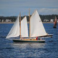
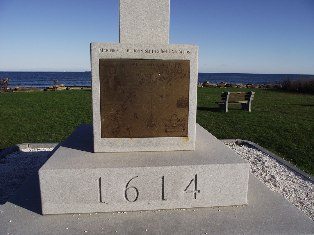
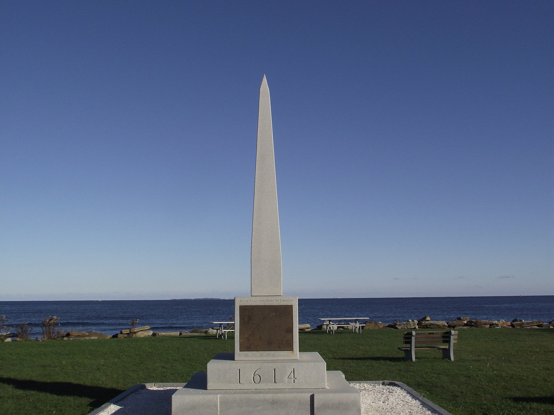
点评:The obelisk 1614 Monument stands on Ragged Neck Point near the center of Rye Harbor State Park. It commemorates Captain John Smith’s exploration and mapping expedition of the New England coastline from Penobscot Bay to Cape Cod in 1614.
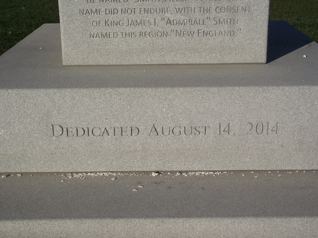
The monument was installed and dedicated in 2014 ~ some 400 years later.
As the 400th anniversary approached, well-known local historian and author J. Dennis Robinson had been very critical in his writings about the original monument out on Star Island in the Isles of Shoals that had fallen into disrepair.
As a result, not only was that restored in time for the anniversary, but this second monument was created.
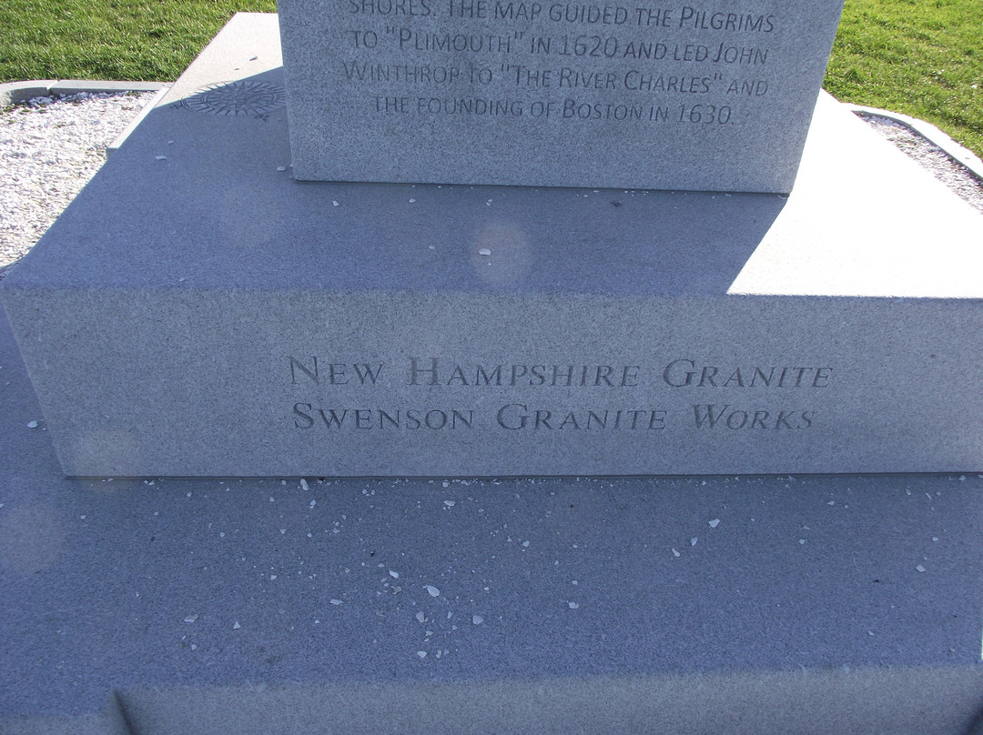
The monument is comprised of four sections of New Hampshire granite. One section of the base bears a carving that gives the origin of the granite as Swenson Granite Works in Concord. It is 17 feet and 2 inches tall. That converts to 16 feet and 14 inches ~ for the year of 1614. Making the monument that height was thoughtful.
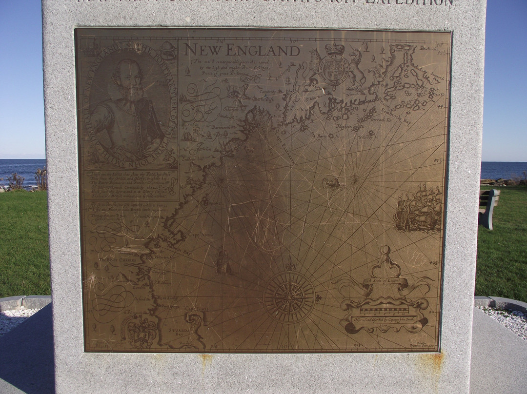
The bronze plaque on the front has an enlarged copy of Smith’s map.
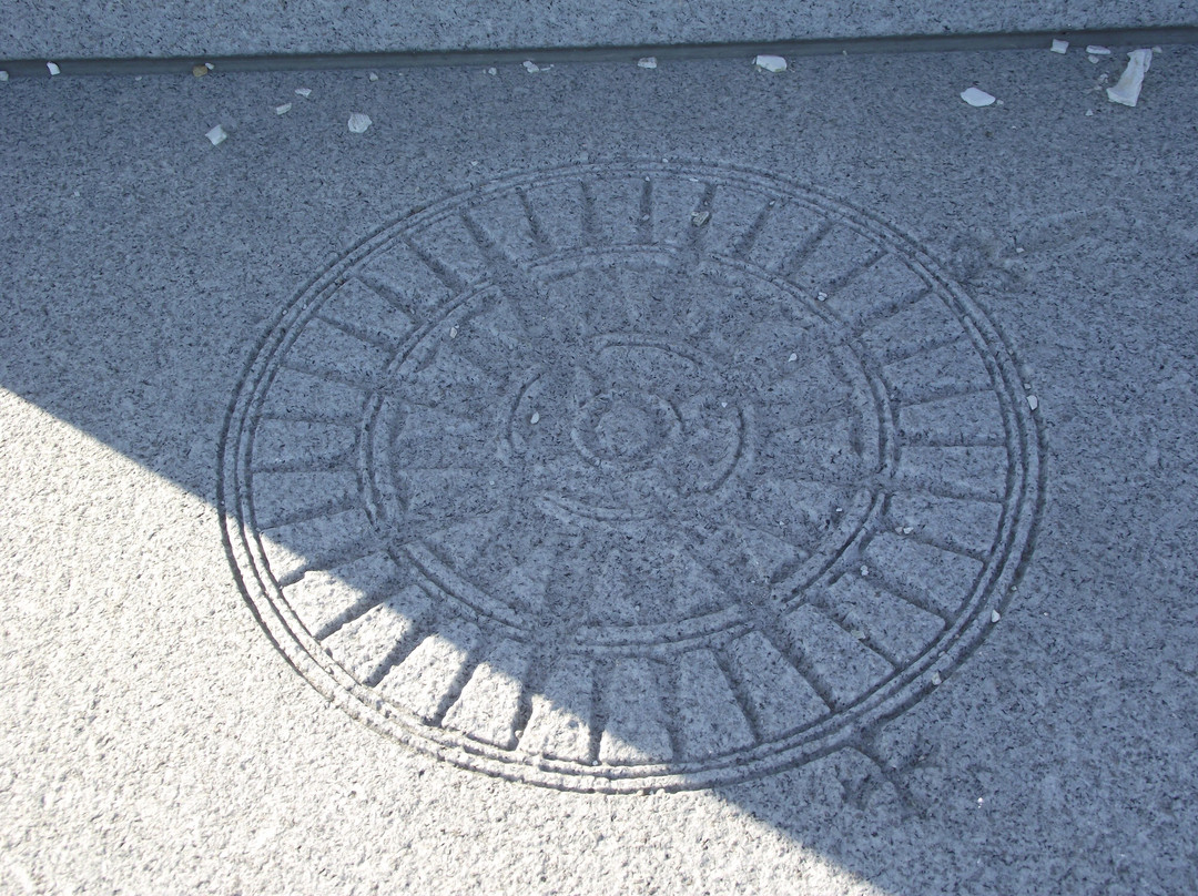
Another plaque features an engraving of the compass rose from the Smith map.
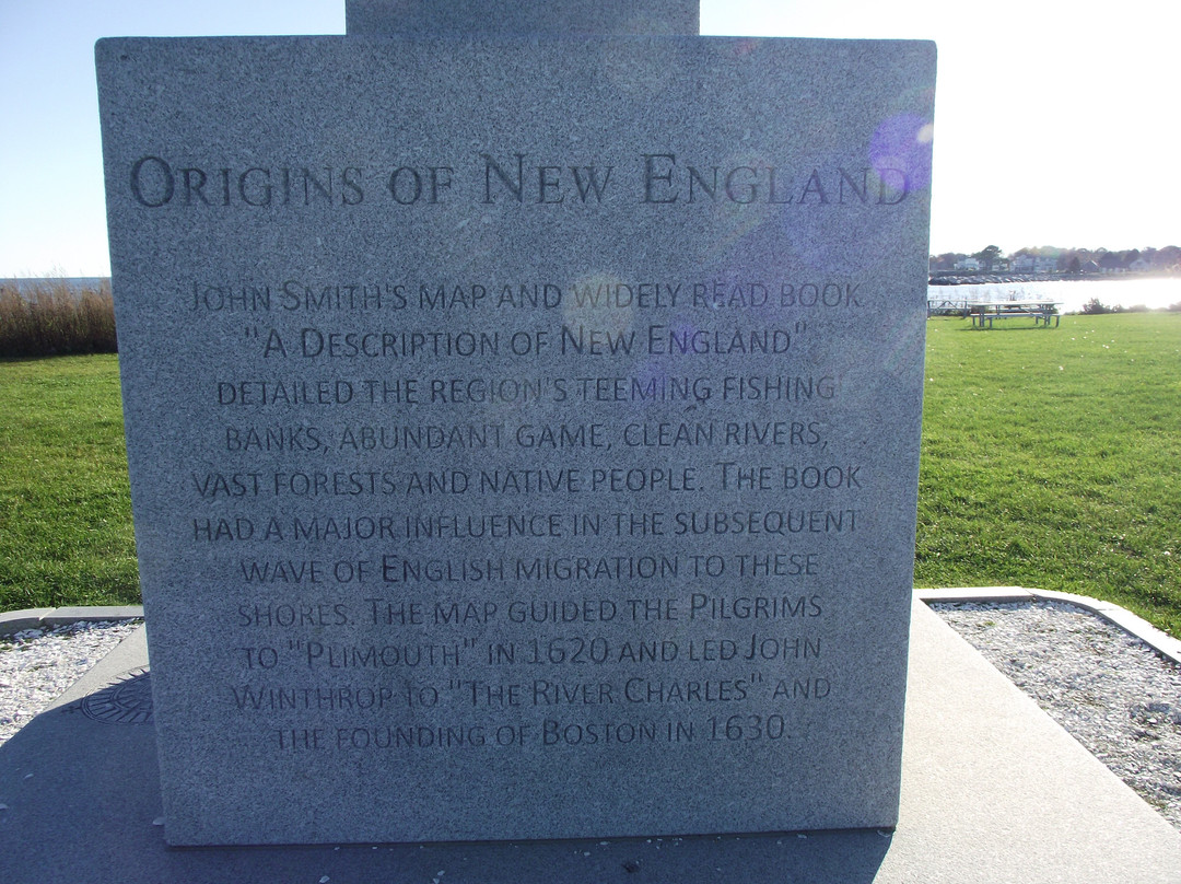
On another side, The Origins of New England are described. It also explained that the map guided the Pilgrims to Plymouth, MA in 1620.
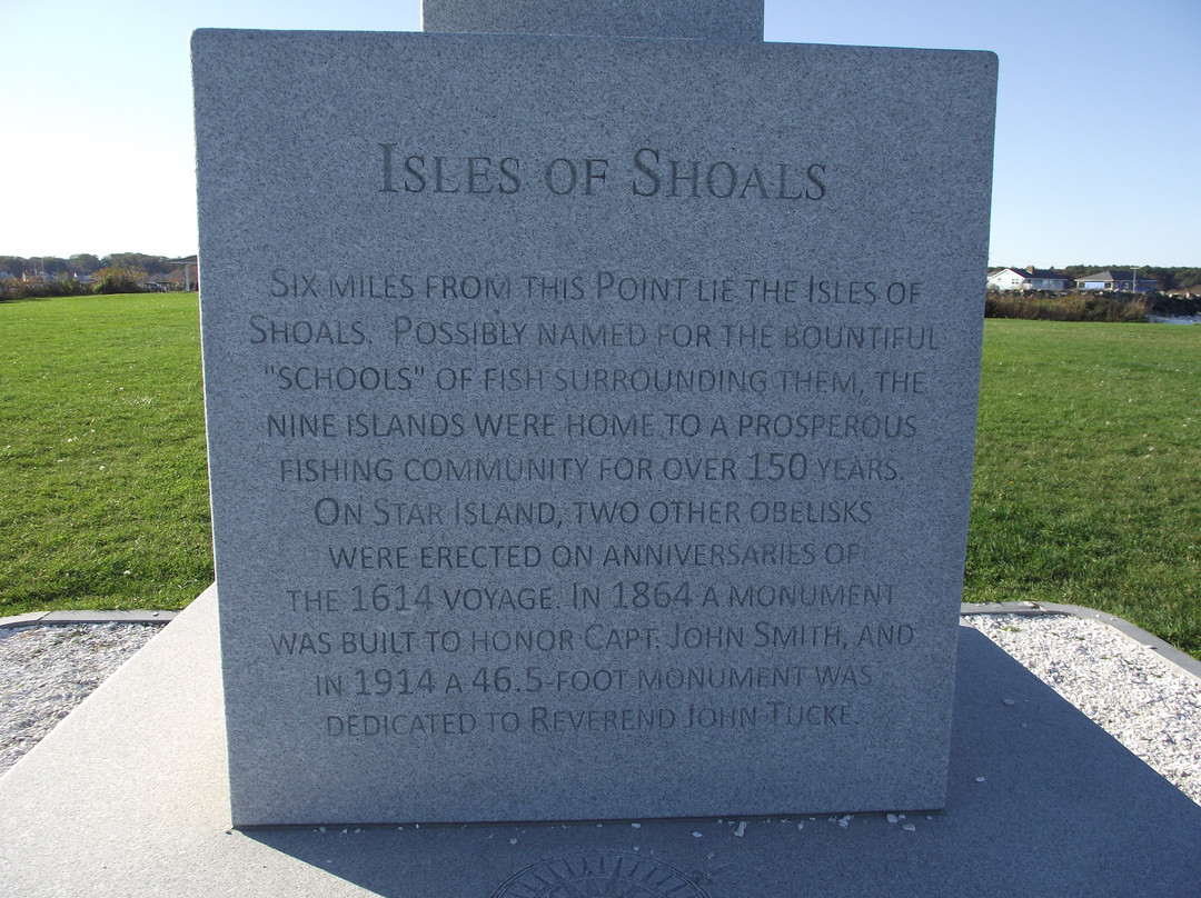
Another side is titled the Isles of Shoals and describes the likely origin of the name. Smith’s account of his exploration included mention of schools of fish surrounding the isles.
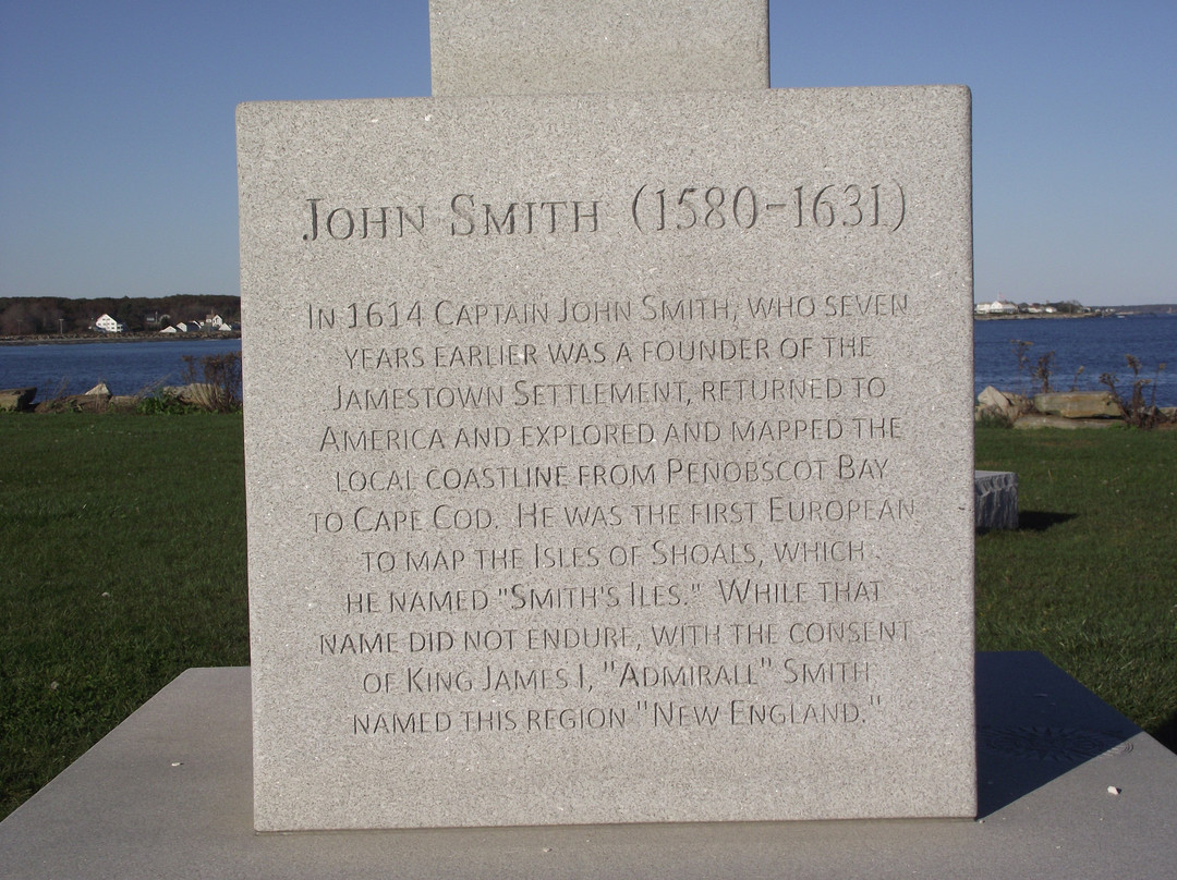
The fourth side is about John Smith (1580 – 1631). It mentions that he was also a founder of the Jamestown Settlement in Virginia.
It’s unusual that the name of his ship for this important undertaking was not documented.
I thought that the monument was very well done. I rate it at 5.0.
The reason for the delay in submitting this review was due to a months-long loss of my ability to post photos with my reviews and some health issues.
If you found this review useful, please click the THUMBS UP to indicate HELPFUL.
The monument was installed and dedicated in 2014 ~ some 400 years later.
As the 400th anniversary approached, well-known local historian and author J. Dennis Robinson had been very critical in his writings about the original monument out on Star Island in the Isles of Shoals that had fallen into disrepair.
As a result, not only was that restored in time for the anniversary, but this second monument was created.
The monument is comprised of four sections of New Hampshire granite. One section of the base bears a carving that gives the origin of the granite as Swenson Granite Works in Concord. It is 17 feet and 2 inches tall. That converts to 16 feet and 14 inches ~ for the year of 1614. Making the monument that height was thoughtful.
The bronze plaque on the front has an enlarged copy of Smith’s map.
Another plaque features an engraving of the compass rose from the Smith map.
On another side, The Origins of New England are described. It also explained that the map guided the Pilgrims to Plymouth, MA in 1620.
Another side is titled the Isles of Shoals and describes the likely origin of the name. Smith’s account of his exploration included mention of schools of fish surrounding the isles.
The fourth side is about John Smith (1580 – 1631). It mentions that he was also a founder of the Jamestown Settlement in Virginia.
It’s unusual that the name of his ship for this important undertaking was not documented.
I thought that the monument was very well done. I rate it at 5.0.
The reason for the delay in submitting this review was due to a months-long loss of my ability to post photos with my reviews and some health issues.
If you found this review useful, please click the THUMBS UP to indicate HELPFUL.
翻译:1614 年方尖碑纪念碑矗立在 Rye Harbor 州立公园中心附近的 Ragged Neck Point。它是为了纪念 1614 年 John Smith 船长对从 Penobscot Bay 到科德角的新英格兰海岸线的探索和测绘探险。
这座纪念碑于 2014 年安装并落成,距今约 400 年。
随着 400 周年纪念日的临近,著名的当地历史学家和作家 J. Dennis Robinson 在他的著作中对位于浅滩群岛星岛上的原始纪念碑提出了严厉批评,该纪念碑已年久失修。
结果,不仅在周年纪念日之前修复了它,而且还建造了第二座纪念碑。
纪念碑由四段新罕布什尔花岗岩组成。底座的一部分刻有雕刻,表明花岗岩的原产地是康科德的 Swenson 花岗岩厂。它高 17 英尺 2 英寸。换算成 16 英尺 14 英寸,也就是 1614 年。将纪念碑设计成这个高度是经过深思熟虑的。
正面的铜牌上有史密斯地图的放大版。
另一块牌匾上刻有史密斯地图上的罗盘玫瑰。
另一面描述了新英格兰的起源。它还解释了这张地图在 1620 年引导清教徒前往马萨诸塞州普利茅斯。
另一面的标题是浅滩群岛,并描述了这个名字的可能起源。史密斯对他的探险的描述包括提到群岛周围的鱼群。
第四面是关于约翰·史密斯 (1580-1631) 的。它提到他也是弗吉尼亚州詹姆斯敦定居点的创始人。
不寻常的是,他的船的名字没有被记录下来,用于这项重要的任务。
我认为这座纪念碑做得很好。我给它打 5.0 分。
延迟提交此评论的原因是由于几个月来我无法发布评论照片,并且有些健康问题。
如果您觉得此评论有用,请点击大拇指表示有用。

© 2026 Tripadvisor 版权所有。
部分照片由 VFM Leonardo 提供。
TripAdvisor公司对外部网站的内容一概不负责。优惠价格中不含税和其他费用。
ICP证:沪B2-20200433
沪ICP备20013175号
 沪公网安备31010502005427号
鹰程信息技术(上海)有限公司