
下载App
资质规则
旅行
账户
PookyCake
Hidden Oasis High Above Daajing Giids
Regier Lake Trail的点评
点评:The Regier Lake Trail is one of five “community trails” in the Village of Daajing Giids. Having hiked all five, I’d suggest Regier is probably the most challenging of the group. It is also the most difficult to find.
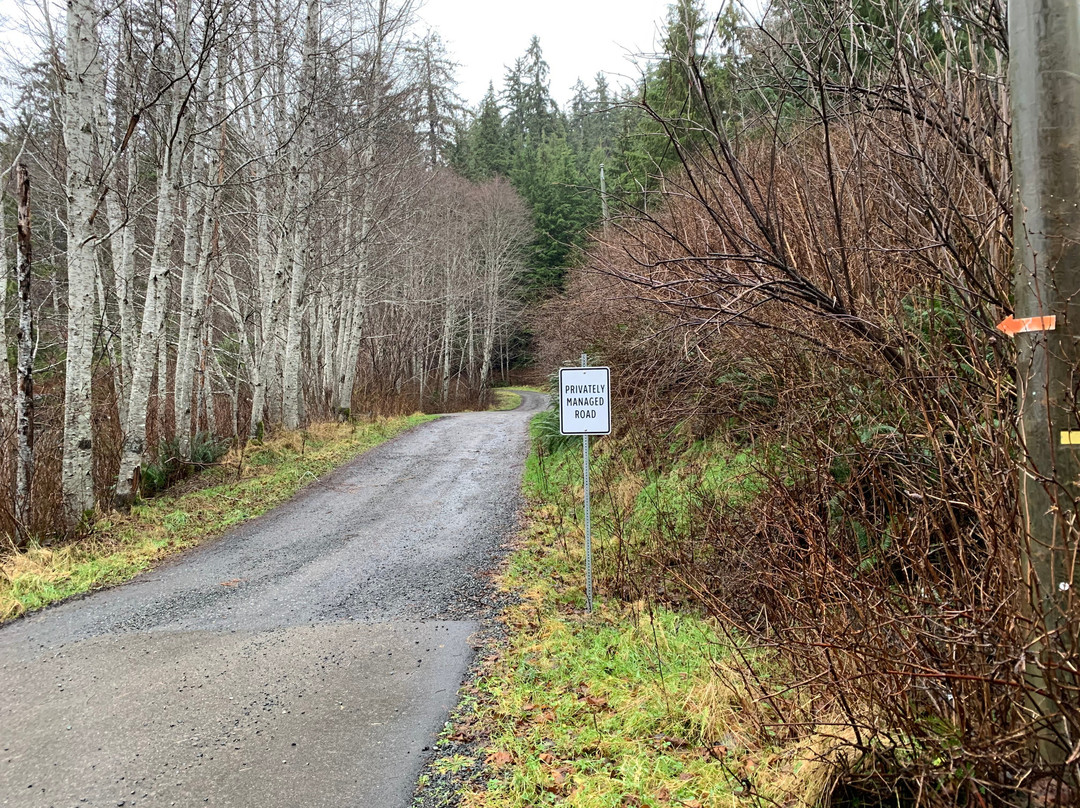
The literature available in Daajing Giids that mentions Regier Lake is all wonderfully vague. The Visitor Centre, for example, says the trailhead can be found at the “termination of 3rd Ave, then drive up a narrow residential dirt road.” I would say that’s partly true, but then you have to ask “which 3rd Avenue?” Vague directions aside, the trail is also a challenge to locate because the trailhead marker has recently been removed.
If you’re up for a challenge, and want to hike Regier Lake, follow these steps:
1) If already staying in Daajing Giids, travel to the east end of the village. Just after you pass Wharf Street (home of J&T Restaurant), you will spy 3rd Avenue on your LEFT. This steep road is also called “Forestry Hill” by the locals. Drive up this road.
2) As you reach the top of the hill, you will see a dirt road to your LEFT. The Regier Lake Trail is at the top of this road; however, there isn’t really any parking for non-residents; thus, I would recommend parking your vehicle on the side of 3rd Avenue and walking up the road.
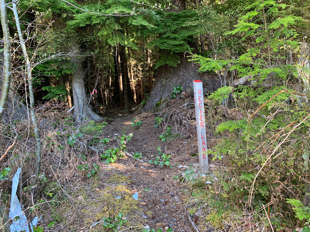
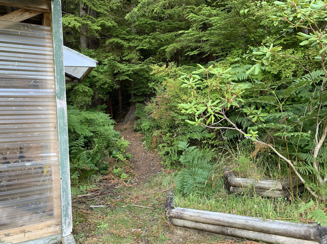
3) Once you reach the top, you should see the trail to your RIGHT immediately beside a small storage shed. The trailhead marker used to be here, built in the same style as Charlie Hartie, Gore Brooke, Crabapple, and Tarundl. Its absence makes the trail a little more difficult to find; however, you should still see some pink spray-paint on a tree, indicating the trail. From here, it’s a 3km trek (one way), and 1,200 feet in elevation gain, to Regier Lake!
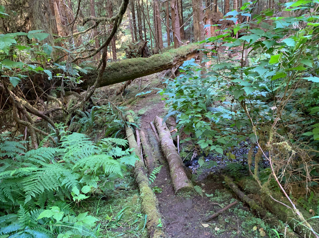
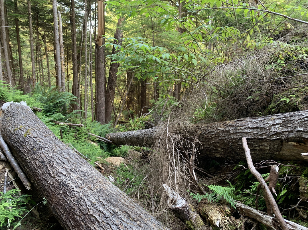
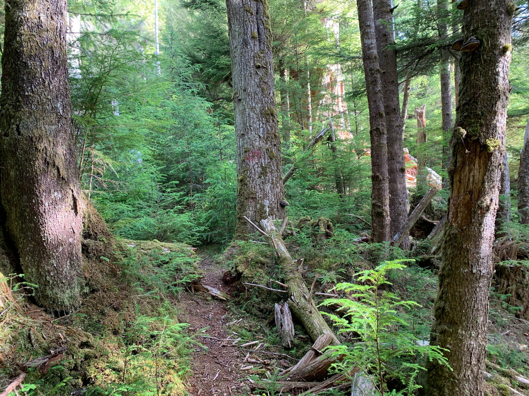
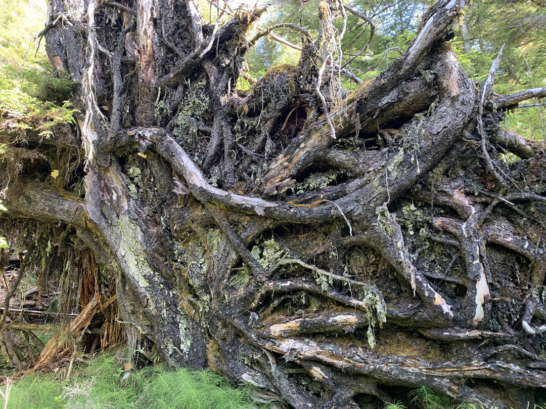
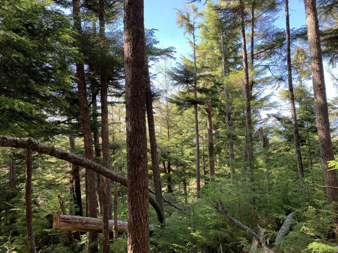
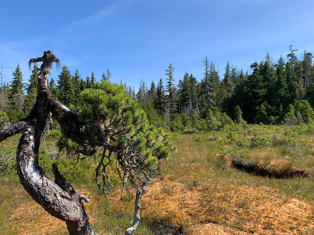
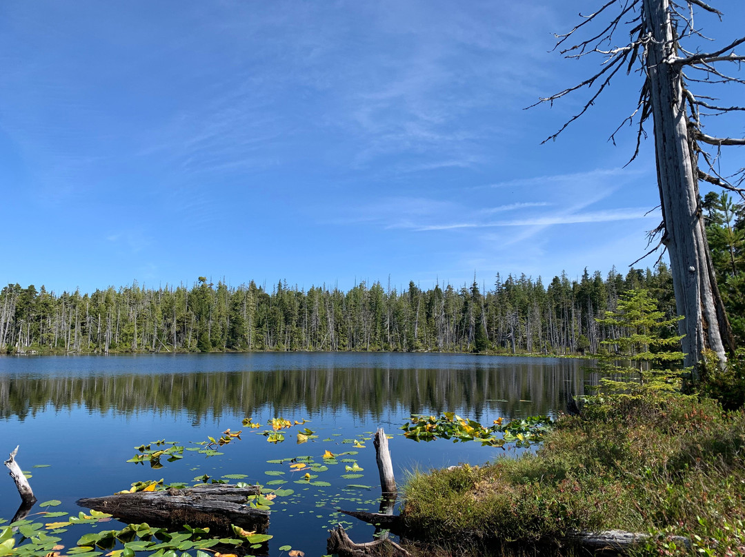
The trail itself is basically an uphill climb right out of the gate. While rough, the trail is well marked with a mix of pink spray-paint, flagging tape, and arrow markers. The early part of the trail is the most challenging, in my opinion, thanks to a number of blowdowns along the route. As you climb higher, the trail eventually flattens upon entering the bog environment. The trail markers are scant at this point, but the path towards the lake is still pretty obvious. When we hiked up, the bog was uncharacteristically dry but Regier Lake was quite beautiful! Plenty of water lilies and a duck enjoying the water! Indeed, this was the perfect place to enjoy a light lunch before hiking back down into Daajing Giids!
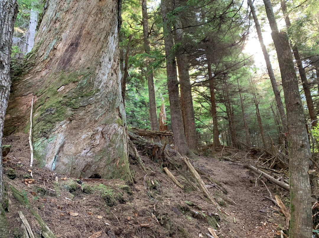
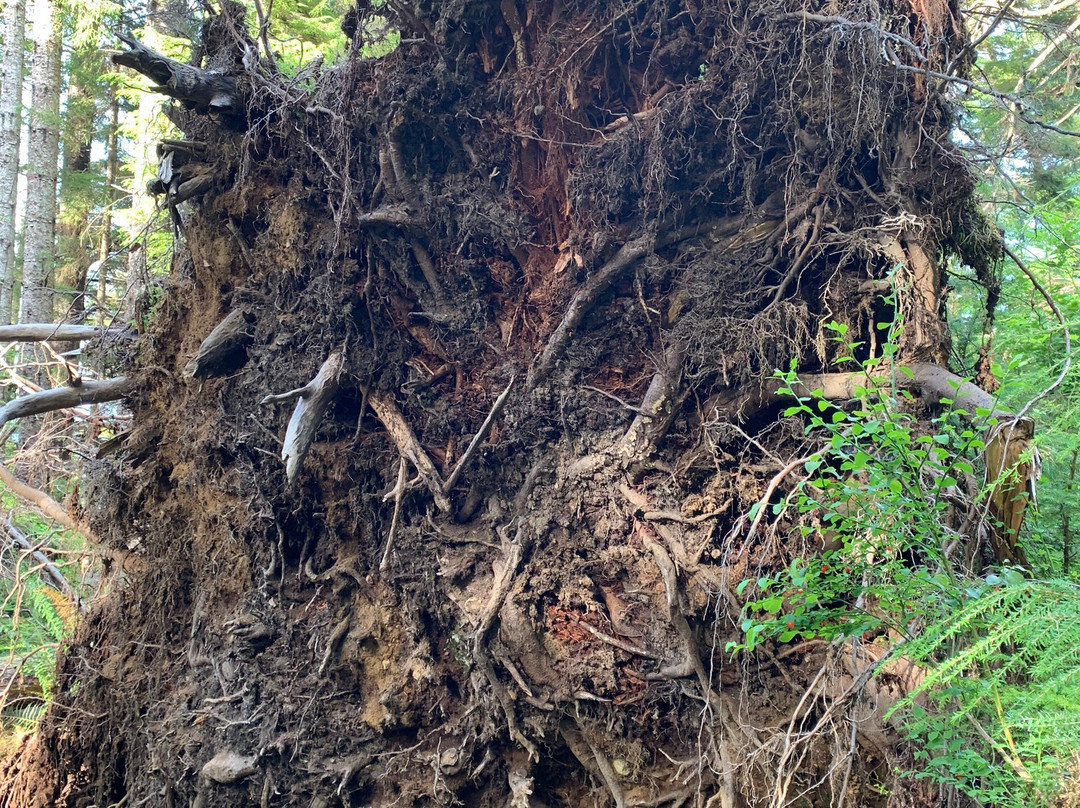
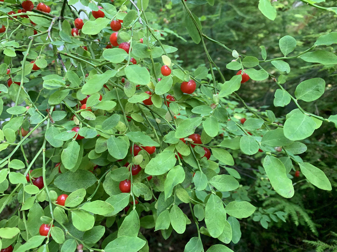
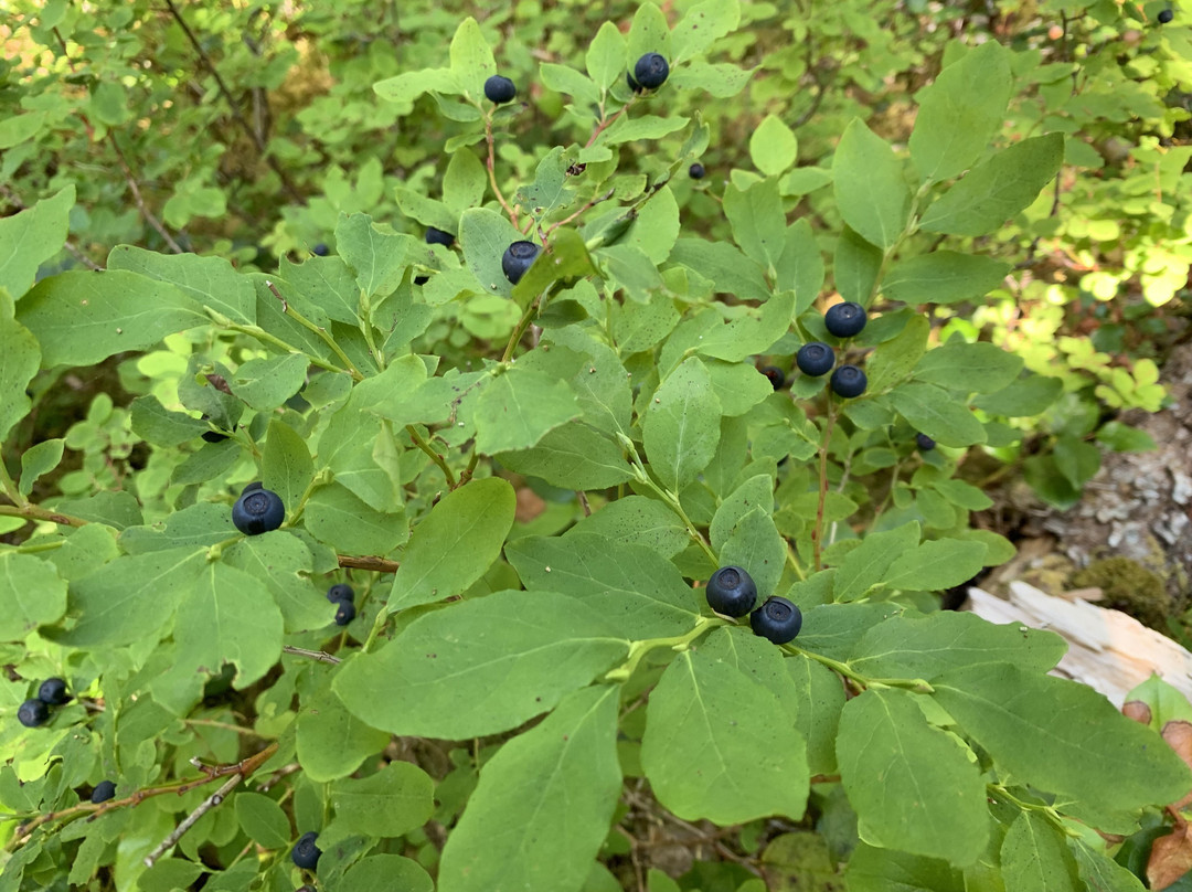
Besides the lake, there are a few old growth cedars to be seen along the trek, plus the unique plants in the delicate bog environment. If hiking in the summer, be sure to enjoy the abundant huckleberries!
It took us about 3 hours, each way, to complete the hike, but we were moving at a very leisurely pace. Others have indicated 2 hours each way is usually sufficient; however, I’d suggest ensuring you leave plenty of daylight for this hike!
The literature available in Daajing Giids that mentions Regier Lake is all wonderfully vague. The Visitor Centre, for example, says the trailhead can be found at the “termination of 3rd Ave, then drive up a narrow residential dirt road.” I would say that’s partly true, but then you have to ask “which 3rd Avenue?” Vague directions aside, the trail is also a challenge to locate because the trailhead marker has recently been removed.
If you’re up for a challenge, and want to hike Regier Lake, follow these steps:
1) If already staying in Daajing Giids, travel to the east end of the village. Just after you pass Wharf Street (home of J&T Restaurant), you will spy 3rd Avenue on your LEFT. This steep road is also called “Forestry Hill” by the locals. Drive up this road.
2) As you reach the top of the hill, you will see a dirt road to your LEFT. The Regier Lake Trail is at the top of this road; however, there isn’t really any parking for non-residents; thus, I would recommend parking your vehicle on the side of 3rd Avenue and walking up the road.
3) Once you reach the top, you should see the trail to your RIGHT immediately beside a small storage shed. The trailhead marker used to be here, built in the same style as Charlie Hartie, Gore Brooke, Crabapple, and Tarundl. Its absence makes the trail a little more difficult to find; however, you should still see some pink spray-paint on a tree, indicating the trail. From here, it’s a 3km trek (one way), and 1,200 feet in elevation gain, to Regier Lake!
The trail itself is basically an uphill climb right out of the gate. While rough, the trail is well marked with a mix of pink spray-paint, flagging tape, and arrow markers. The early part of the trail is the most challenging, in my opinion, thanks to a number of blowdowns along the route. As you climb higher, the trail eventually flattens upon entering the bog environment. The trail markers are scant at this point, but the path towards the lake is still pretty obvious. When we hiked up, the bog was uncharacteristically dry but Regier Lake was quite beautiful! Plenty of water lilies and a duck enjoying the water! Indeed, this was the perfect place to enjoy a light lunch before hiking back down into Daajing Giids!
Besides the lake, there are a few old growth cedars to be seen along the trek, plus the unique plants in the delicate bog environment. If hiking in the summer, be sure to enjoy the abundant huckleberries!
It took us about 3 hours, each way, to complete the hike, but we were moving at a very leisurely pace. Others have indicated 2 hours each way is usually sufficient; however, I’d suggest ensuring you leave plenty of daylight for this hike!
翻译:Regier 湖步道是 Daajing Giids 村的五条“社区步道”之一。我徒步走过了所有五条步道,我认为 Regier 步道可能是其中最具挑战性的。它也是最难找到的。
Daajing Giids 中提到的 Regier 湖的文献都非常模糊。例如,游客中心说步道的起点位于“第三大道的尽头,然后沿着一条狭窄的住宅土路行驶”。我认为这部分是正确的,但然后你必须问“哪个第三大道?”除了模糊的方向之外,这条步道的定位也具有挑战性,因为步道起点标记最近已被移除。
如果您愿意接受挑战,并想徒步穿越 Regier 湖,请按照以下步骤操作:
1) 如果您已经住在 Daajing Giids,请前往村庄的东端。经过码头街(J&T 餐厅的所在地)后,您会在左侧看到第三大道。当地人也把这条陡峭的道路称为“森林山”。沿着这条路往上走。
2) 到达山顶后,您会在左侧看到一条土路。Regier 湖步道位于这条路的顶部;但是,这里实际上没有非居民的停车位;因此,我建议您将车辆停在第三大道的一侧,然后沿着路往上走。
3) 到达山顶后,您应该会在右侧看到一条小路,就在一个小仓库旁边。步道起点标记曾经在这里,其建造风格与 Charlie Hartie、Gore Brooke、Crabapple 和 Tarundl 相同。它的消失使得这条步道更难找到;但是,您仍然应该看到一棵树上有一些粉红色的喷漆,指示着这条步道。从这里到 Regier 湖需要徒步 3 公里(单程),海拔增加 1,200 英尺!
这条步道本身基本上是一出门就上坡的。虽然崎岖不平,但这条小路的标记清晰,上面混合着粉色喷漆、标记带和箭头标记。在我看来,这条小路的早期部分最具挑战性,因为沿途有许多倒下的树木。随着你爬得更高,小路最终在进入沼泽环境时变平。此时的路标很少,但通往湖泊的路径仍然非常明显。当我们徒步上山时,沼泽异常干燥,但雷吉尔湖非常漂亮!有很多睡莲,还有一只鸭子在水中嬉戏!事实上,这是在徒步返回 Daajing Giids 之前享用一顿清淡午餐的完美地点!
除了湖泊,在徒步旅行途中还可以看到几棵古老的雪松,以及脆弱的沼泽环境中独特的植物。如果在夏天徒步旅行,一定要享受丰富的越橘!
我们每次徒步大约花了 3 个小时完成徒步旅行,但我们的步伐非常悠闲。其他人表示单程 2 小时通常就足够了;然而,我建议确保为这次徒步旅行留出充足的日光!

© 2026 Tripadvisor 版权所有。
部分照片由 VFM Leonardo 提供。
TripAdvisor公司对外部网站的内容一概不负责。优惠价格中不含税和其他费用。
ICP证:沪B2-20200433
沪ICP备20013175号
 沪公网安备31010502005427号
鹰程信息技术(上海)有限公司